
CAI Property Cards
Click here to connect to our GIS- Geological Information System and Property Cards.
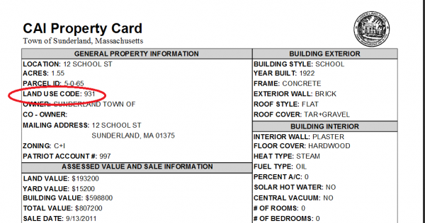
CAI Property Cards have data updated monthly, including owner property ,sketch, photo and assessed value as it becomes available.
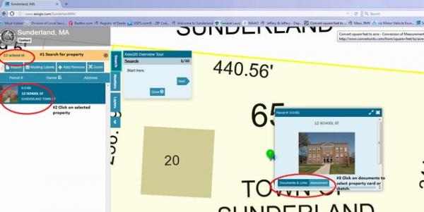
Click on image below to view steps to find a property card. Each Property Card also lists a Land Use Code.
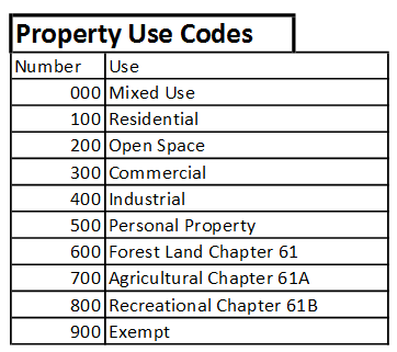
The Chart below shows the general catagories. For a more detailed listing click the link above for Land Use Codes.
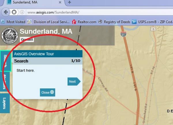
You may also get an AxisGis Overview Tour for more user options.
For more detailed instructions: Axis GIS -Geological Information System Tutorial